
Description
Product details
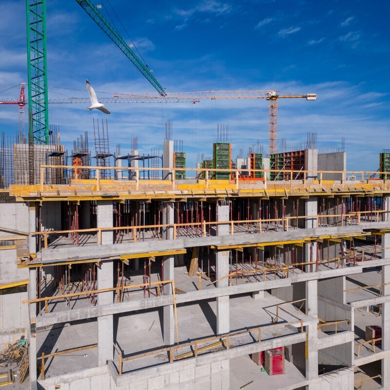
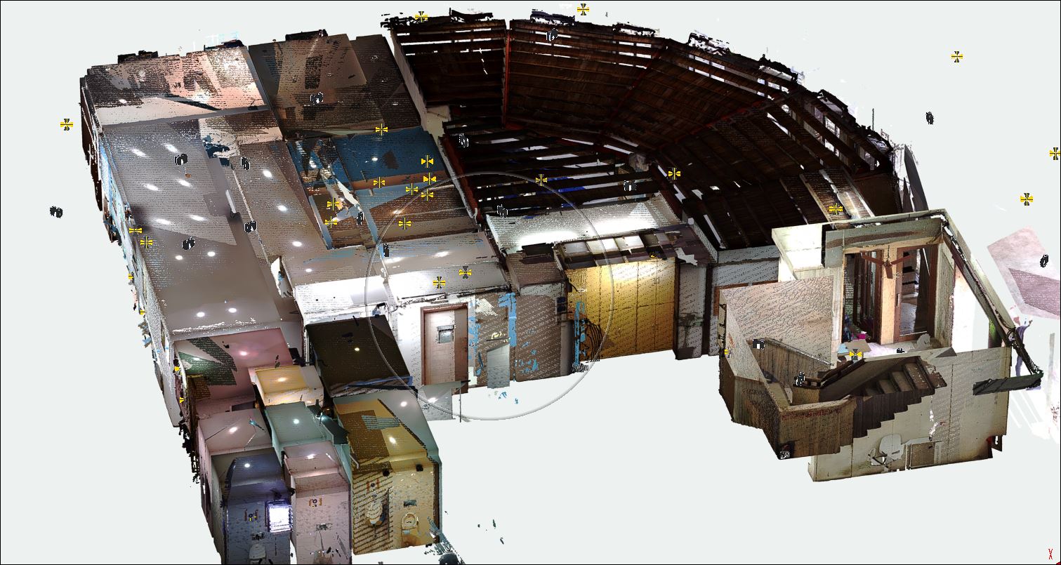
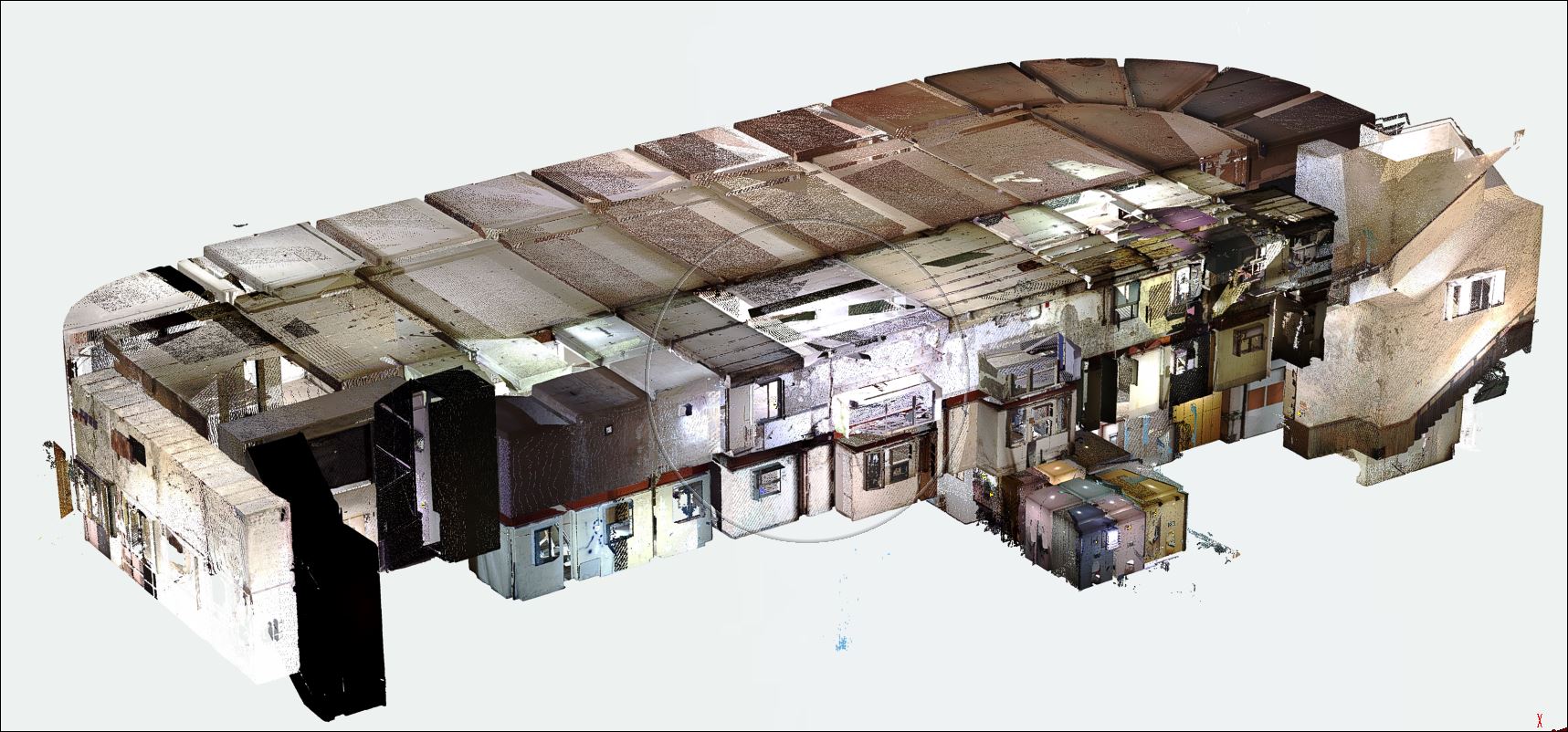
3D Scanning for Civil & Construction Projects Using Terrestrial Scanners and Drone Photogrammetry ========================================================== At Variational Technologies, we specialize in delivering cutting-edge 3D scanning and drone photogrammetry solutions for civil and construction projects across India. By utilizing advanced terrestrial 3D scanners and aerial drones, we provide precise, detailed, and actionable data to enhance project planning, execution, and monitoring. Our team ensures fast and accurate surveys, enabling customers to save time, reduce costs, and eliminate errors. Whether it's a topographic survey, structural analysis, or heritage preservation, our services cater to diverse project needs, ensuring clients achieve their goals with efficiency and precision. =========================================================== How It Works 1. Terrestrial Scanners: Use laser or LiDAR (Light Detection and Ranging) technology. A tripod-mounted scanner emits laser beams that measure distances and angles to create a detailed 3D map. The scanner rotates 360°, capturing millions of data points (point cloud) for a complete, accurate representation of structures or terrain. 2. Drone Photogrammetry: A drone equipped with high-resolution cameras or LiDAR captures aerial images. Overlapping images from multiple angles are processed using specialized software to generate a 3D model. The process combines GPS data for accurate georeferencing. 3. Data Processing: The point cloud or photogrammetric data is converted into 3D models using software like AutoCAD, Revit, or specialized BIM (Building Information Modeling) tools. This data is used for visualization, analysis, and integration with existing project models. =========================================================== Applications 1. Site Surveys and Mapping: Accurate topographic surveys for land development and planning. Monitoring progress and comparing it to project timelines. 2. Construction Planning: Clash detection between existing structures and planned additions. Optimizing the placement of equipment and materials on-site. 3. Structural Analysis: Assessing the condition of existing buildings, bridges, or monuments. Detecting deformations, cracks, or deviations from design standards. 4. Heritage Preservation: Documenting historical sites for restoration or digital archiving. 5. Volume Calculations: Calculating stockpile volumes in quarries, mines, or construction sites. 6. Utilities and Infrastructure: Mapping underground utilities and assessing road, pipeline, or rail conditions. ======================================================================================== Our Customers • Builders & Developers: For accurate property designs and updates. • Industrial Operators: For facility upgrades and space optimization. • Heritage Conservators: For digital restoration of historic sites. • MEP Engineers: For enhanced mechanical, electrical, and plumbing designs.


